

Vous suivez désormais
Erreur de suivi de l'utilisateur.
Cet utilisateur n'utilise pas les utilisateurs à le suivre.
Vous suivez déjà cet utilisateur.
Votre plan d'adhésion ne permet que 0 suivis. Améliorez ici.
Ne suit désormais plus
Erreur lors de l'arrêt du suivi de l'utilisateur.
Vous avez désormais recommandé
Erreur lors de la recommendation de l'utilisateur.
Une erreur a eu lieu. Veuillez rafraîchir la page et réessayer.
E-mail désormais vérifié.

rawalpindi,
pakistan
Il est actuellement 4:59 AM ici
Rejoint le juillet 27, 2021
1
Recommandation
Mahwish M.
@mahwishmuzammil
5,5
5,5
100%
100%
rawalpindi,
pakistan
100 %
Travaux complétés
100 %
Suivant le budget
100 %
Dans les temps
15 %
Taux de réembauche
ESRI Certified | GIS | Cartographer | Digitizer
Contactez Mahwish M. concernant votre travail
Connectez-vous pour discuter de tous les détails via la messagerie.
Portfolio
Portfolio
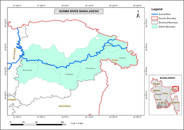

Flood Hazard Mapping of surma River

Flood Hazard Mapping of surma River

Flood Hazard Mapping of surma River

Flood Hazard Mapping of surma River


Get Lat Long from Address Convert Address to Coordinates
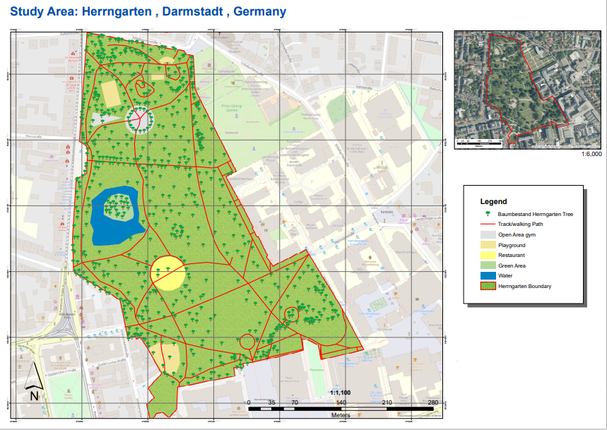

thesis Map
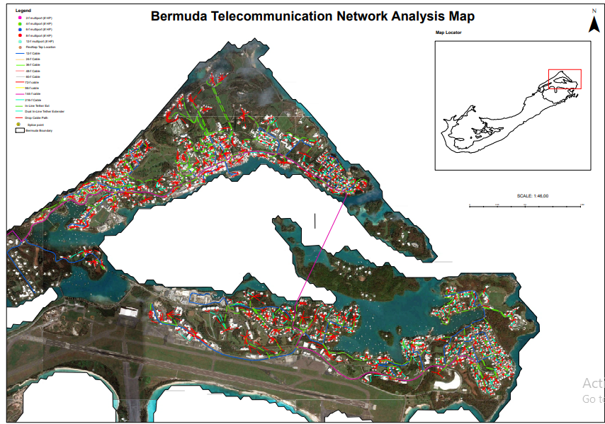

FTTH (Fiber Mapping)

FTTH (Fiber Mapping)


Georeferenced and Digitizing map in ArcGIS


Great American Road Trip Map
Flood Hazard Mapping of surma River
Flood Hazard Mapping of surma River
Flood Hazard Mapping of surma River
Flood Hazard Mapping of surma River
Get Lat Long from Address Convert Address to Coordinates
thesis Map
FTTH (Fiber Mapping)
FTTH (Fiber Mapping)
Georeferenced and Digitizing map in ArcGIS
Great American Road Trip Map
Commentaires
Modifications enregistrées
Montre1 - 5 sur 14 commentaires
$48,00 USD
C# Programming
Cartography & Maps
C++ Programming
Geographical Information System (GIS)

•
$230,00 USD
Cartography & Maps
Geospatial
Image Processing
Geographical Information System (GIS)
3D Visualization
B

•
€30,00 EUR
Cartography & Maps
Machine Learning (ML)
Data Mining
Geospatial
Data Science
N

•
$1 917,00 USD
Cartography & Maps
Geolocation
Geospatial
Google Maps API
ArcGIS

•
₹1 600,00 INR
Cartography & Maps
Geospatial
Google Maps API
Geographical Information System (GIS)
+1 de plus
•
Expérience
GIS Specialist
janv. 2013 - Jusqu'à présent
main duties are Create maps and graphs, using GIS software and related equipment. Accurately adding and editing GIS data to the base map. Georeferencing, Geographic data preparation and Management of database. Manage data repository.
GIS Analyst
janv. 2010 - févr. 2012 (2 ans, 1 mois)
Main duties were to Digitize SOP Sheets and from Google Earth Software, Hazard zones identification.
Éducation
B.A
(2 ans)
ICS
(2 ans)
Contactez Mahwish M. concernant votre travail
Connectez-vous pour discuter de tous les détails via la messagerie.
Vérifications
Certifications
Meilleures compétences
Parcourir les freelances similaires
Parcourir les présentations similaires
Invitation désormais envoyée !
Merci ! Nous vous avons envoyé un lien par e-mail afin de réclamer votre crédit gratuit.
Une erreur a eu lieu lors de l'envoi de votre e-mail. Veuillez réessayer.
Échec de copie dans le presse-papier, veuillez réessayer après avoir ajuster vos permissions.
Copié dans le presse-papier.
Chargement de l'aperçu
Permission donnée pour la géolocalisation.
Votre session de connexion a expiré et vous avez été déconnecté. Veuillez vous connecter à nouveau.