

Vous suivez désormais
Erreur de suivi de l'utilisateur.
Cet utilisateur n'utilise pas les utilisateurs à le suivre.
Vous suivez déjà cet utilisateur.
Votre plan d'adhésion ne permet que 0 suivis. Améliorez ici.
Ne suit désormais plus
Erreur lors de l'arrêt du suivi de l'utilisateur.
Vous avez désormais recommandé
Erreur lors de la recommendation de l'utilisateur.
Une erreur a eu lieu. Veuillez rafraîchir la page et réessayer.
E-mail désormais vérifié.

santiago de chile,
chile
Il est actuellement 6:25 AM ici
Rejoint le novembre 29, 2017
1
Recommandation
Jonathan M.
@jdmorillo
3,3
3,3
82%
82%
santiago de chile,
chile
100 %
Travaux complétés
100 %
Suivant le budget
100 %
Dans les temps
43 %
Taux de réembauche
Geodethic Engineer and Geomatist
Contactez Jonathan M. concernant votre travail
Connectez-vous pour discuter de tous les détails via la messagerie.
Portfolio
Portfolio

QGIS Certification

Esri Venezuela / ArcGIS Online Certificate

Autodesk / Autocad certification.
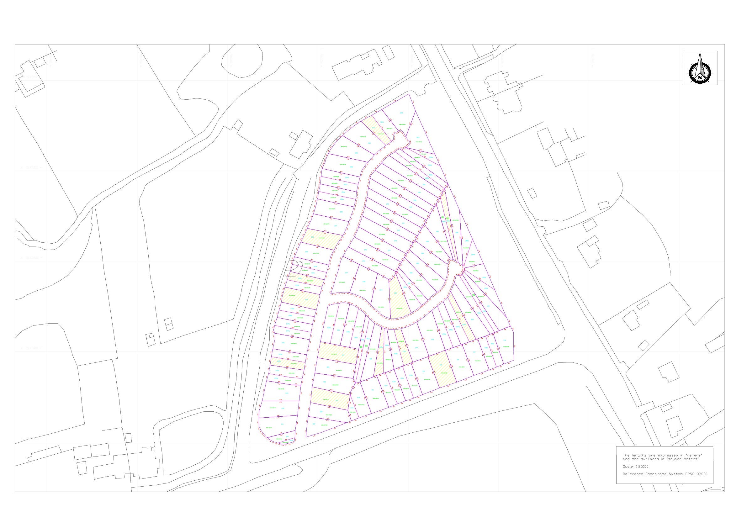

Georeferencing and Digitalization using GIS and Autocad.

Georeferencing and Digitalization using GIS and Autocad.


Georeferenciación y digitalización de cartografía
QGIS Certification
Esri Venezuela / ArcGIS Online Certificate
Autodesk / Autocad certification.
Georeferencing and Digitalization using GIS and Autocad.
Georeferencing and Digitalization using GIS and Autocad.
Georeferenciación y digitalización de cartografía
Commentaires
Modifications enregistrées
Montre1 - 5 sur 9 commentaires
$60,19 AUD
Data Entry
Excel
Cartography & Maps
Geolocation
+1 de plus
S

•
$70,00 USD
Website Design
Graphic Design
Logo Design
Illustration
HTML
T

•
€50,00 EUR
AutoCAD
Google Earth

•
$30,00 USD
Cartography & Maps
T
•
$60,00 USD
Cartography & Maps
Geolocation
Google Earth
Geospatial
Google Maps API
T
•
Expérience
Geospatial Analyst
août 2009 - Jusqu'à présent
Preparation of thematic maps at different representation scales, using Geographic Information Systems (GIS) platforms. Design, implementation and management of Geographic Information Systems for different purposes, using various software. Management and administration of data in vector and raster format for the Spatial Data Infrastructure (IDE). Digital treatment of different remote sensing platforms, used in the generation of different cartographic products.
Éducation
Academic (Geomatics Specialist)
(3 ans)
Academic (Geodethic Engineering)
(6 ans)
Qualifications
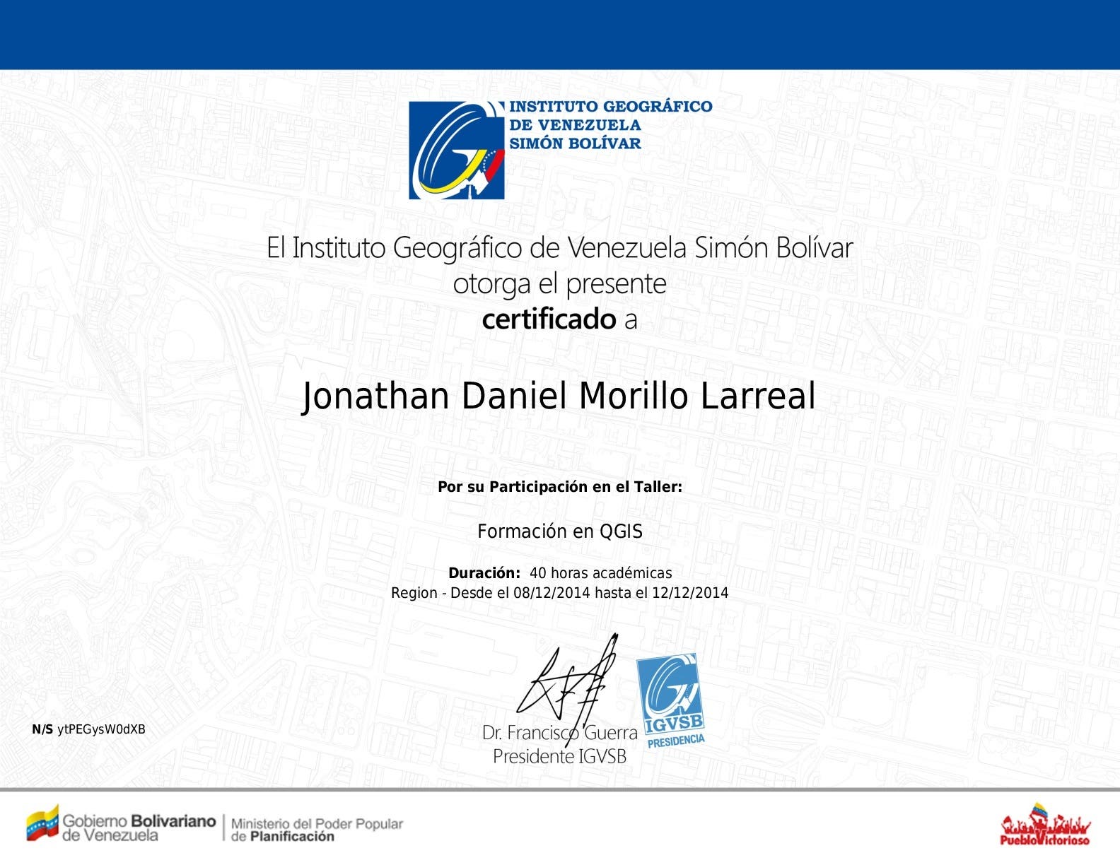
QGIS Formation
Simon Bolívar Geographical Institute of Venezuela
2014
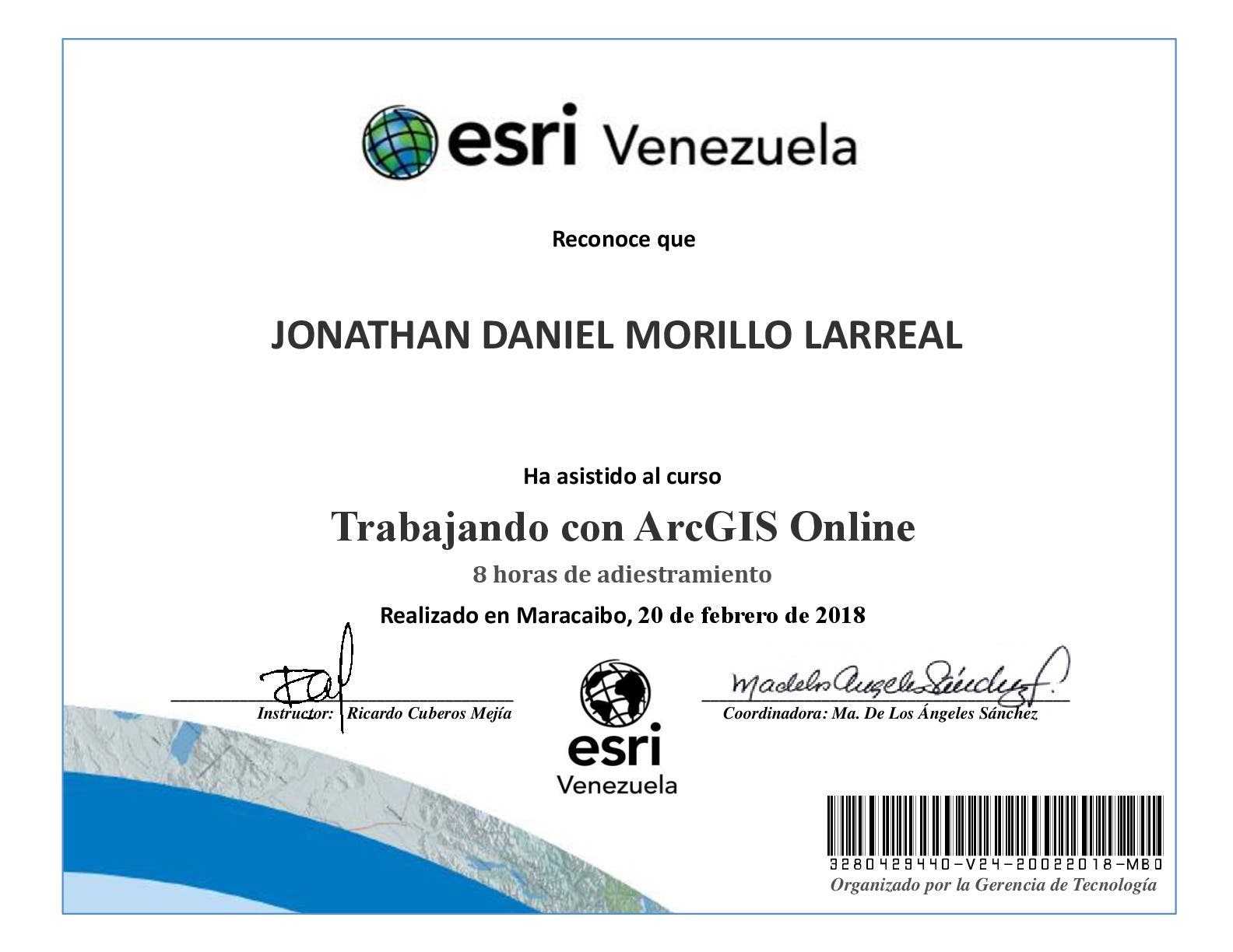
QGIS Formation
ArcGIS Online
Esri Venezuela
2018
Certificate of attendance for the ArcGis Online workshop of Esri Venezuela
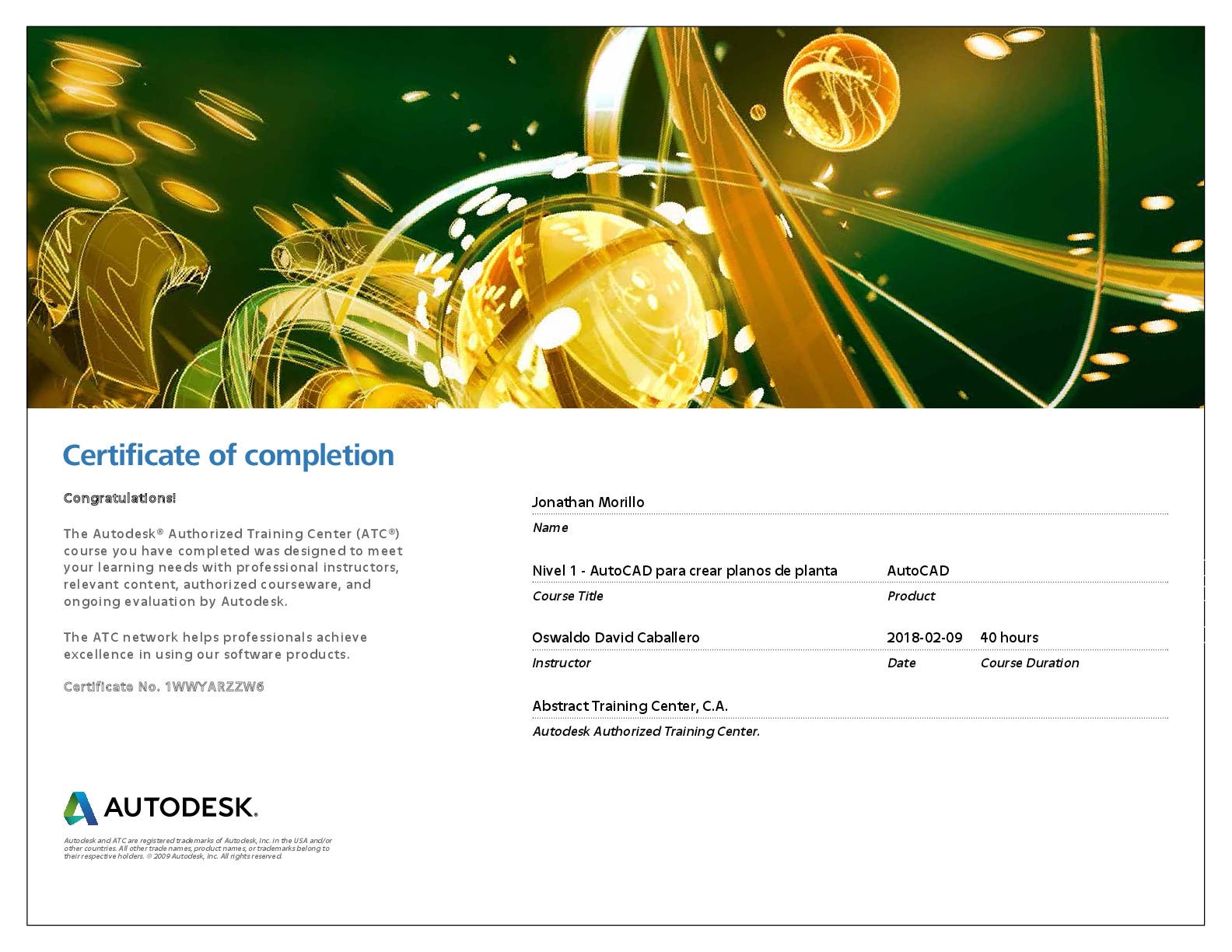
Autodesk - Autocad 2018. Creation of floor plans.
Autodesk
2018
Autocad 2018. Creation of floor plans. The participant will be able to generate 2D drawings in AutoCAD® as required in their work. The use of the drawing tool in plan, expression in the plan so that it is understood by any person, boundary all idea every design must have a real base and for this it must be given measurements to make the specifications of the design and printing.
Contactez Jonathan M. concernant votre travail
Connectez-vous pour discuter de tous les détails via la messagerie.
Vérifications
Certifications
Meilleures compétences
Parcourir les freelances similaires
Parcourir les présentations similaires
Invitation désormais envoyée !
Merci ! Nous vous avons envoyé un lien par e-mail afin de réclamer votre crédit gratuit.
Une erreur a eu lieu lors de l'envoi de votre e-mail. Veuillez réessayer.
Échec de copie dans le presse-papier, veuillez réessayer après avoir ajuster vos permissions.
Copié dans le presse-papier.
Chargement de l'aperçu
Permission donnée pour la géolocalisation.
Votre session de connexion a expiré et vous avez été déconnecté. Veuillez vous connecter à nouveau.