
Vous suivez désormais
Erreur de suivi de l'utilisateur.
Cet utilisateur n'utilise pas les utilisateurs à le suivre.
Vous suivez déjà cet utilisateur.
Votre plan d'adhésion ne permet que 0 suivis. Améliorez ici.
Ne suit désormais plus
Erreur lors de l'arrêt du suivi de l'utilisateur.
Vous avez désormais recommandé
Erreur lors de la recommendation de l'utilisateur.
Une erreur a eu lieu. Veuillez rafraîchir la page et réessayer.
E-mail désormais vérifié.

dakar,
senegal
Il est actuellement 11:57 AM ici
Rejoint le juillet 17, 2020
0
Recommandations
Pape Souleymane D.
@SalomonDiop
6,1
6,1
100%
100%
dakar,
senegal
100 %
Travaux complétés
87 %
Suivant le budget
100 %
Dans les temps
12 %
Taux de réembauche
GIS | Remote sensing | Mapping | Data
Contactez Pape Souleymane D. concernant votre travail
Connectez-vous pour discuter de tous les détails via la messagerie.
Portfolio
Portfolio
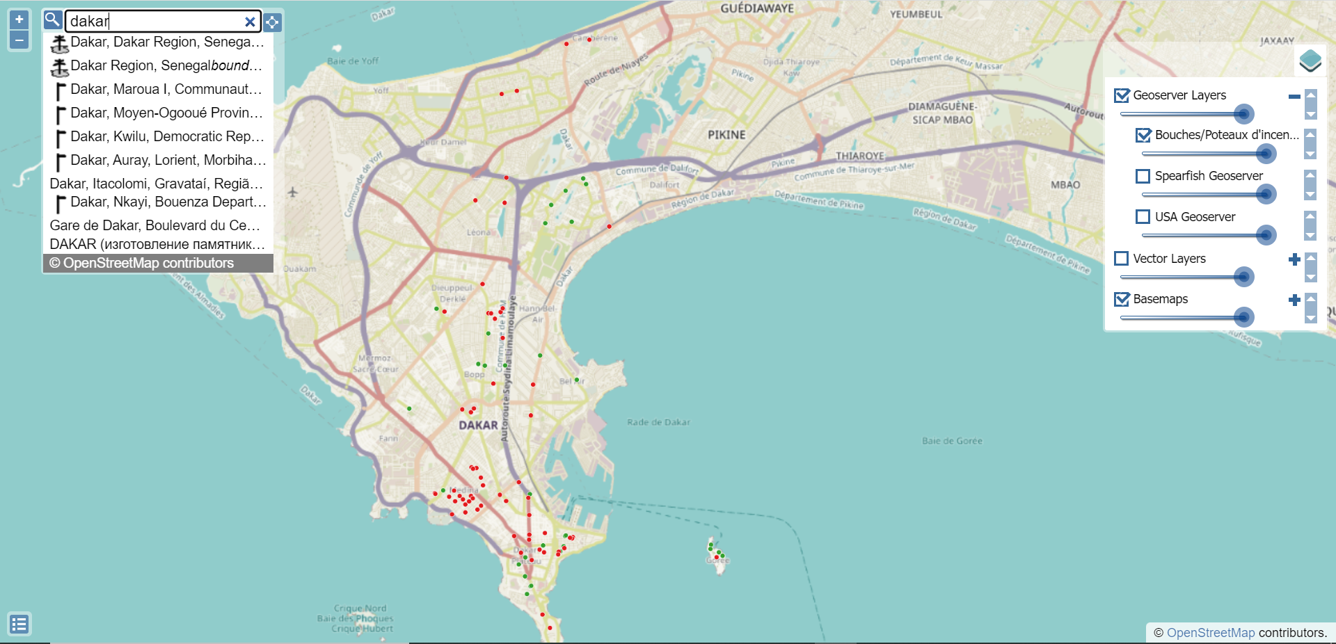

Interactive web map with GIS data


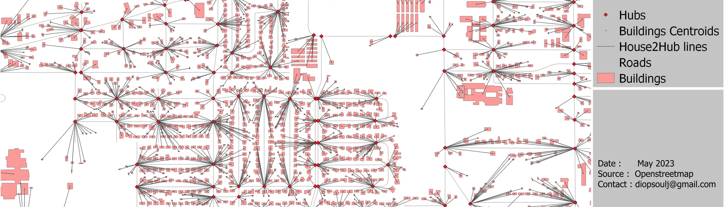
FTTH fiber plan using Openstreetmap data
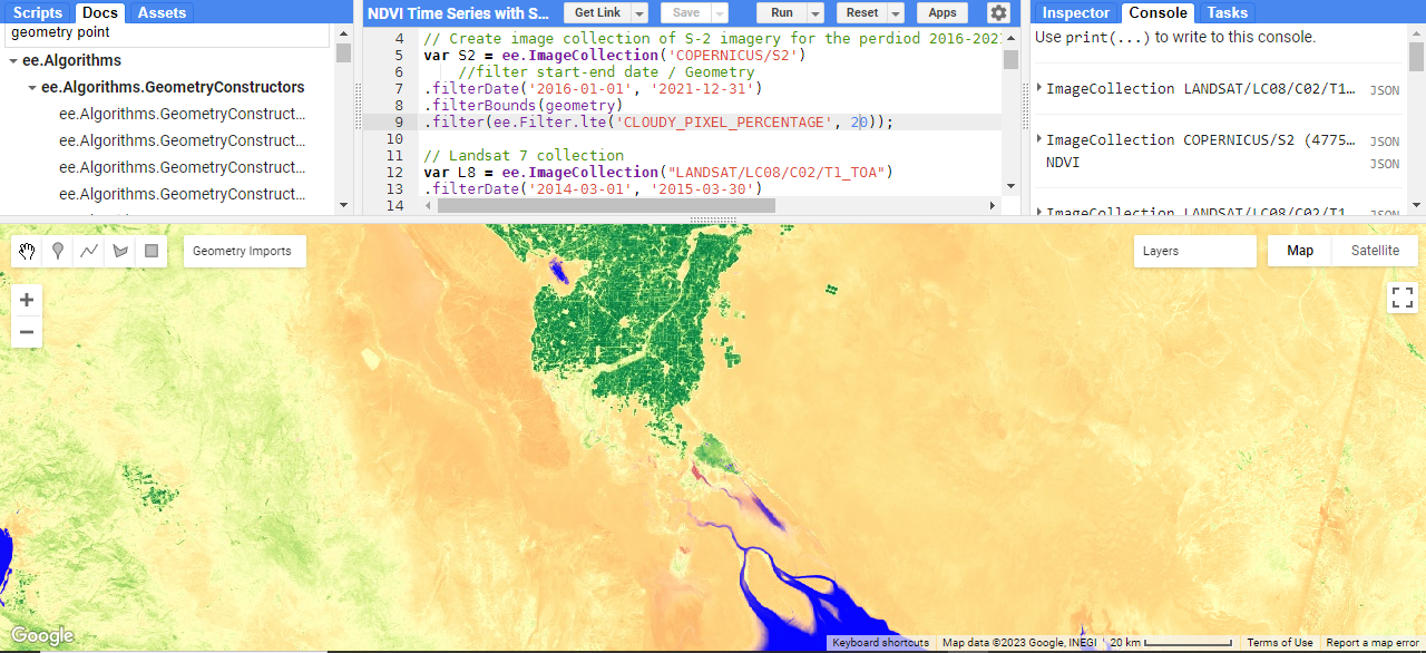

Time series NDVI across an area (part of the world)
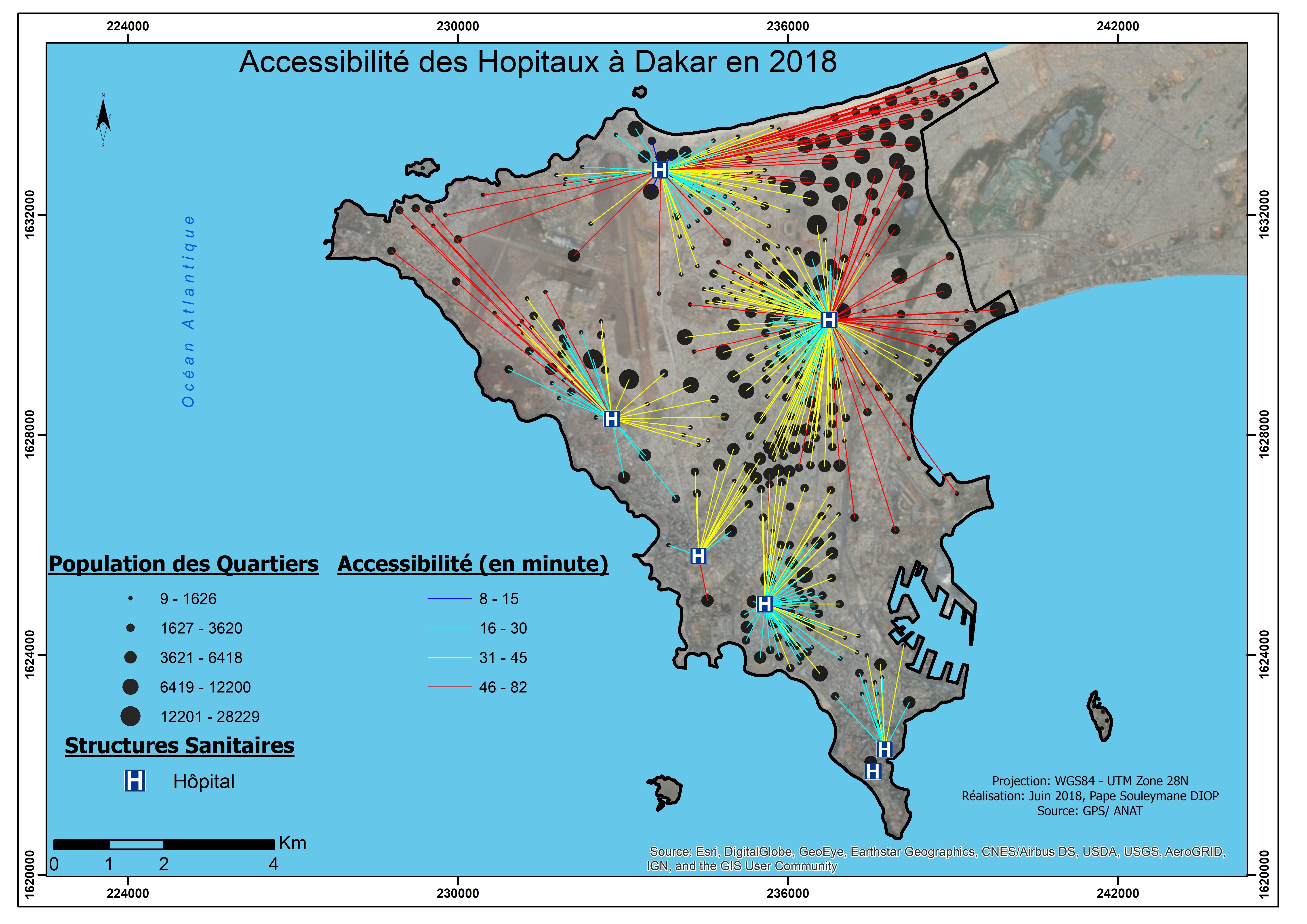

Hopital Accesibility
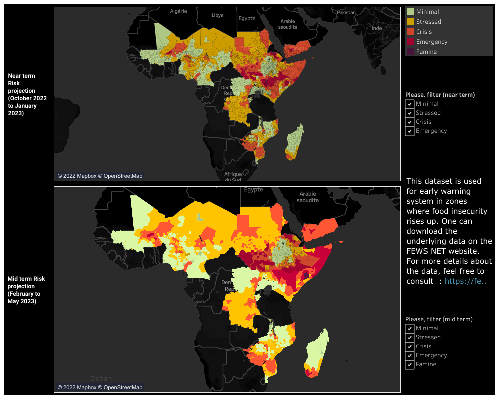

Dashboard of the Food security Risk based on FEWS NET data
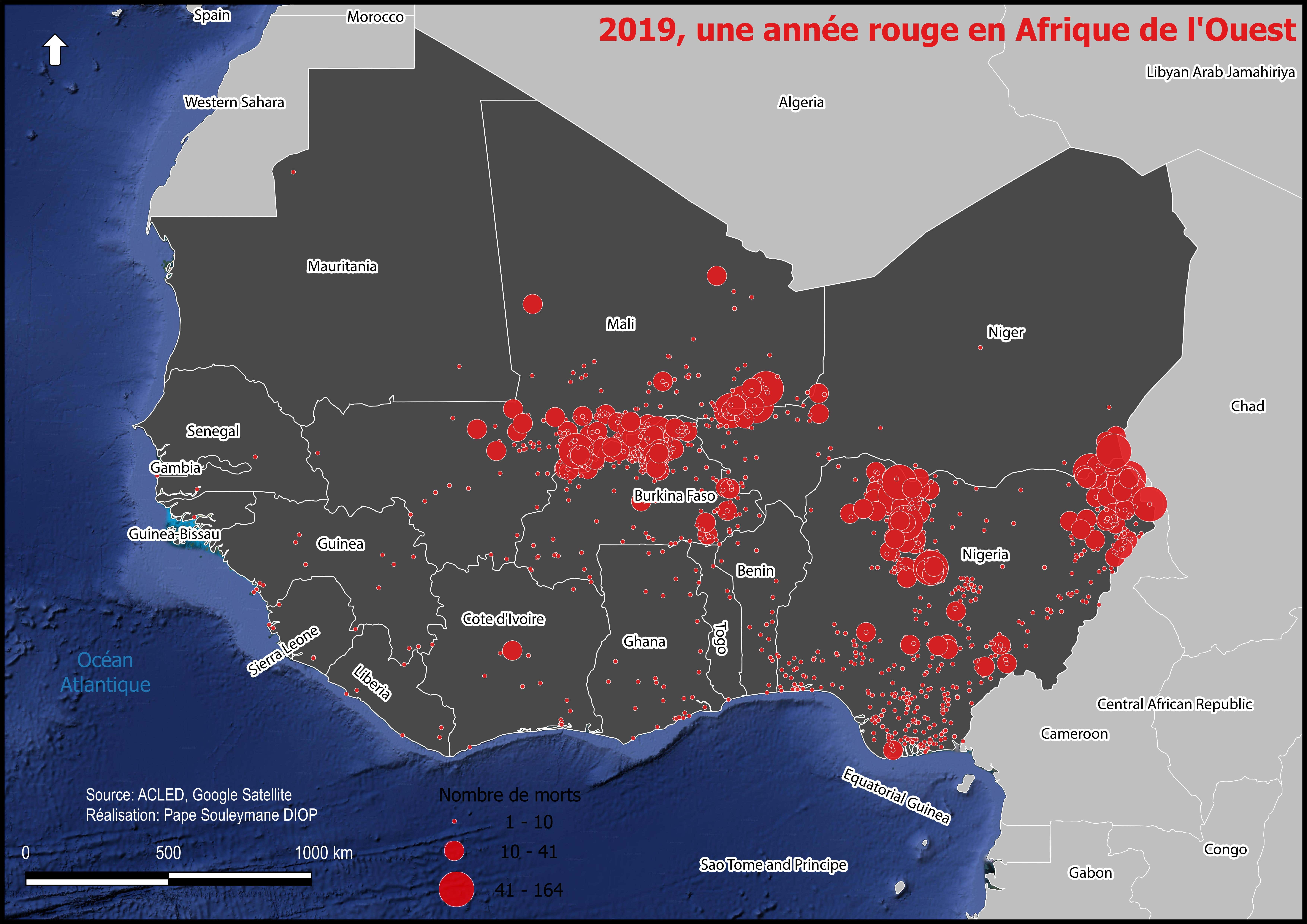

Insecurity in the Sahel region, Western Africa in 2019
Interactive web map with GIS data
FTTH fiber plan using Openstreetmap data
Time series NDVI across an area (part of the world)
Hopital Accesibility
Dashboard of the Food security Risk based on FEWS NET data
Insecurity in the Sahel region, Western Africa in 2019
Commentaires
Modifications enregistrées
Montre1 - 5 sur 10 commentaires
$400,00 USD
Cartography & Maps
Geographical Information System (GIS)

•
$500,00 CAD
Google Earth
Imaging
Geospatial
C

•
$210,00 USD
Cartography & Maps
Geolocation
Geospatial
R Programming Language
•
$3 483,00 AUD
Excel
Cartography & Maps
Google Earth
Geospatial
+1 de plus

•
$750,00 USD
Geolocation
Google Earth
Geospatial
Geographical Information System (GIS)
ArcGIS

•
Expérience
GIS Consultant
nov. 2020 - Jusqu'à présent
As a GIS consultant I have worked for a wide variety of clients including NGO, National agencies....
My work area are so far Senegal, Mali, Burkina Faso, France (remote), Australia (remote), USA (remote)
Some examples of this work are :
- Mapping Cropland in Northern Mali,
- Dashboard on HEA dataset
- Photogrammetric restitution for Senegal's planning agency...
GIS/Technical Assistant
juil. 2019 - nov. 2020 (1 an, 4 mois)
GIS and technical assistant for the Senegalese national Environnemental Direction.
Éducation
Associate Degree in Geomatics
(2 ans)
Contactez Pape Souleymane D. concernant votre travail
Connectez-vous pour discuter de tous les détails via la messagerie.
Vérifications
Meilleures compétences
Parcourir les freelances similaires
Parcourir les présentations similaires
Invitation désormais envoyée !
Merci ! Nous vous avons envoyé un lien par e-mail afin de réclamer votre crédit gratuit.
Une erreur a eu lieu lors de l'envoi de votre e-mail. Veuillez réessayer.
Échec de copie dans le presse-papier, veuillez réessayer après avoir ajuster vos permissions.
Copié dans le presse-papier.
Chargement de l'aperçu
Permission donnée pour la géolocalisation.
Votre session de connexion a expiré et vous avez été déconnecté. Veuillez vous connecter à nouveau.